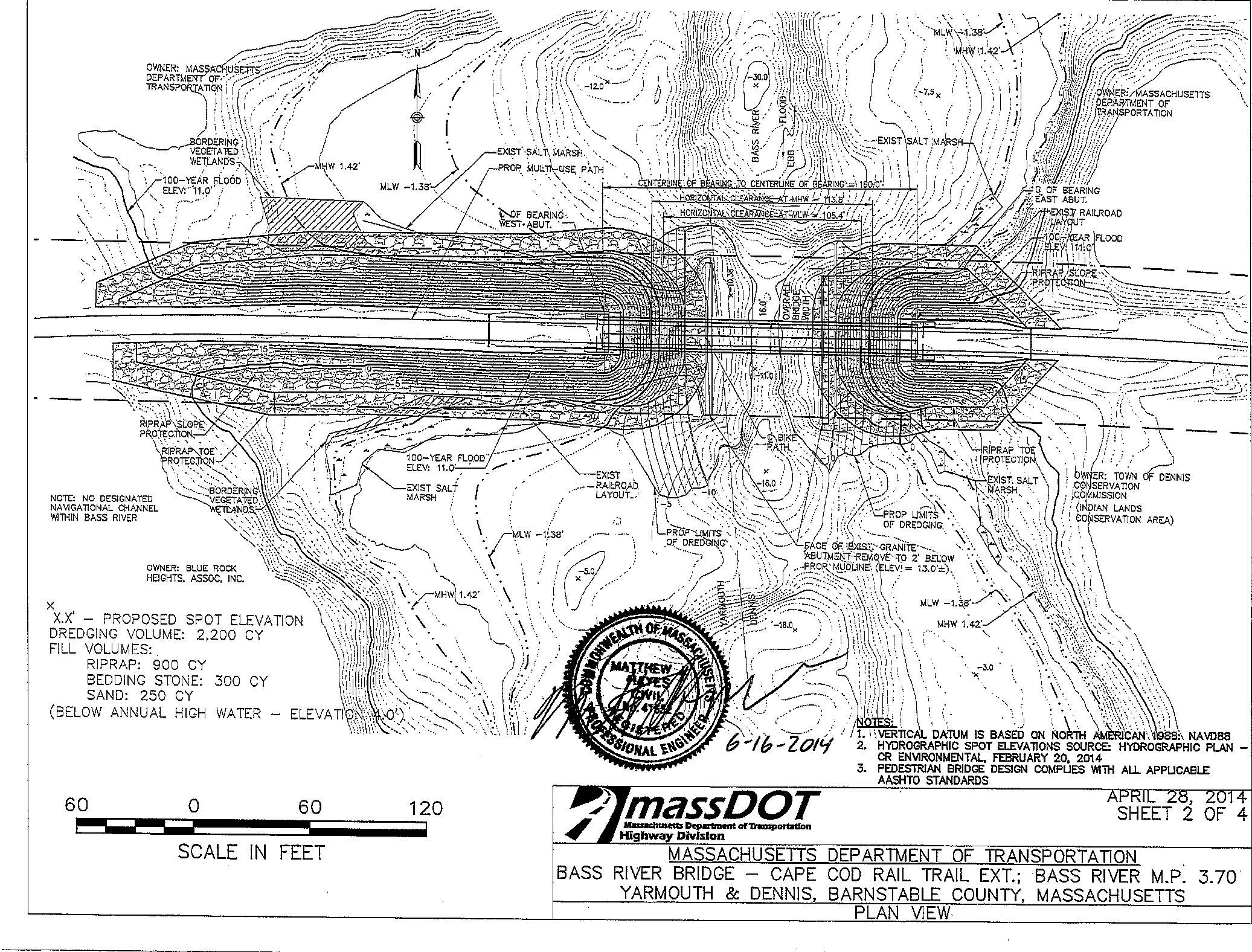
The following diagrams were prepared by the Massachusetts Department of Transportation, and were included in the Coast Guard's request for comments on the Rail Trail Bass River crossing project (Planning for a rail trail extension over Bass River).
The proposal would remove the stone abutments which once held the steel girders of the railroad bridge, cut the east and west causeways back, rip-rap them, add a one-piece footbridge, and dredge the channel. Click on the figure for a bigger version.
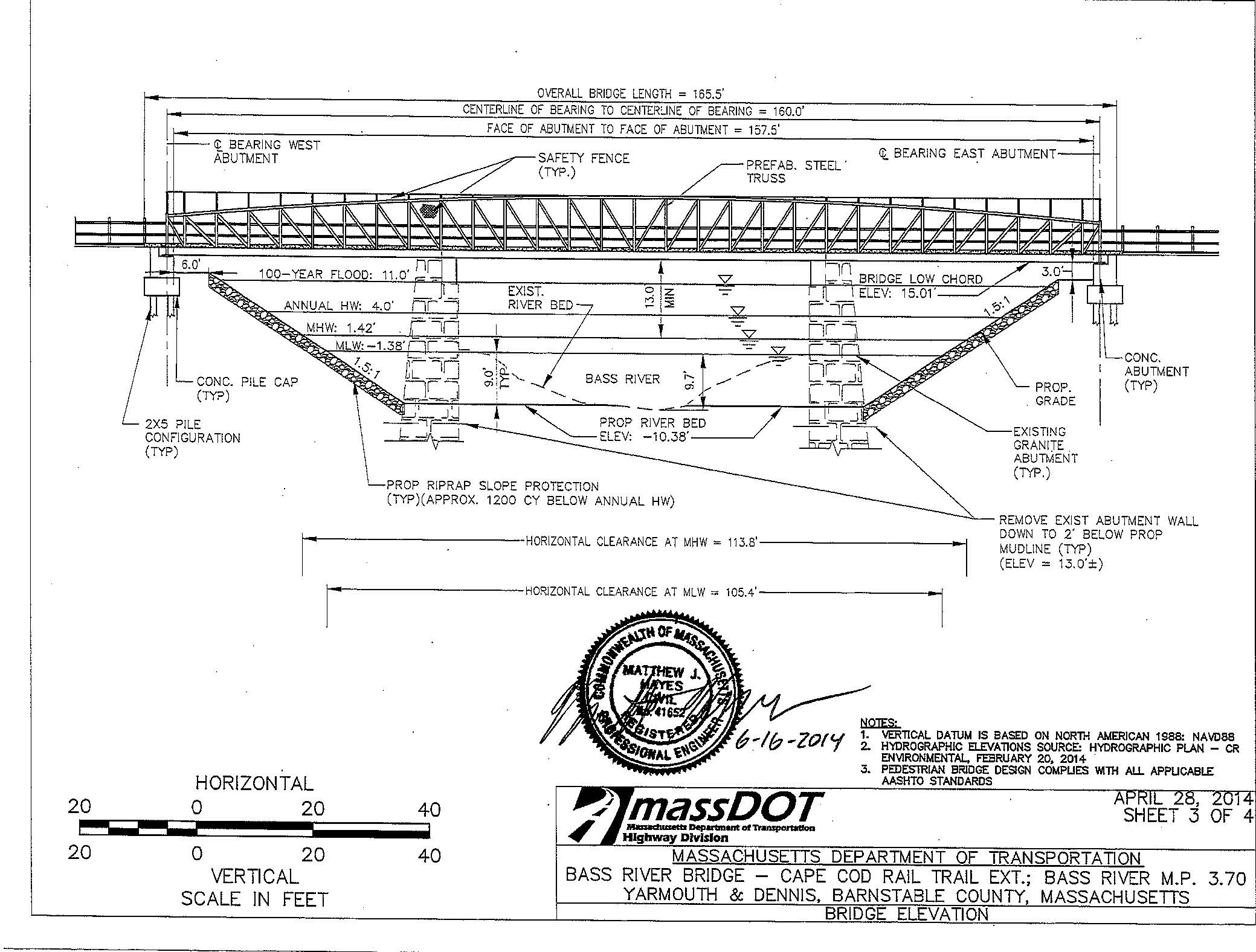
The next diagram shows the existing stone abutments, which would be removed under the plan. A casual reading of the diagram makes it look like they would remain in place, supporting the footbridge; that's not the plan, however. The waterway will increase from about 60 feet wide to about 105 feet (at mean low water).
Leave a Reply