The original bridge between West Dennis and South Yarmouth was built by a private corporation in 1832. In 1870, the towns and the county bought out the corporation and took over responsibility for the bridge. By 1891, it was in poor shape and the towns of Dennis and Yarmouth, with some help from the county, built a replacement. (One of the Bass River bridges is missing…).
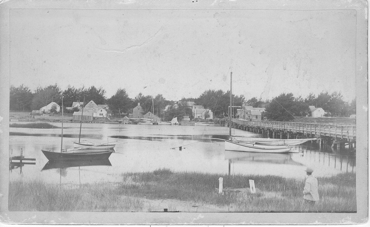
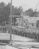
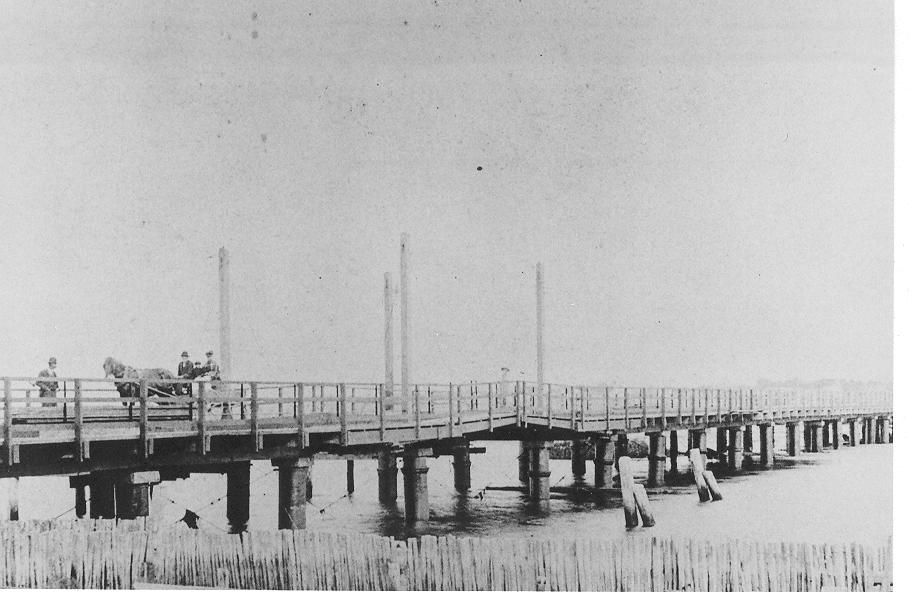
The first bridge, and its replacement, differed in many ways, but one way is obvious from a distance and makes it possible to tell which bridge you are looking at in an old photo (this may also be helpful for dating the photo). Both bridges had a drawbridge over the channel on the Yarmouth side so that the roadbed could be lifted out of the way, allowing vessels to pass. The roadbed on the first bridge rose up to the drawbridge from both sides, while the roadbed of the second bridge was more or less flat, all the way across.
The picture below is of the first bridge from the Dennis side, and it is possible to make out the roadbed and drawbridge over near the Yarmouth side.
Source: Courtesy of the Historical Society of Old Yarmouth
The Historical Society of Old Yarmouth used this photo on the dust jacket of their book Images in Time. I'm grateful for the permission of the Society to use it here. Images has a second picture of the first bridge, taken from an angle that shows the drawbridge and the roadbed more clearly, on page 89. However, I think the picture used here makes the point adequately. The following clip from the photo above focuses on the area near the drawbridge.
Source: Courtesy of the Historical Society of Old Yarmouth
Contrast the drawbridge on the first bridge with the flat roadbed through the drawbridge area on the second bridge, which is shown in the following picture. This picture is taken from the Yarmouth side and gives a good view.
Source: Barry Homer Collection, Courtesy of the Historical Society of Old Yarmouth
Why does it matter, that one bridge was replaced by the other? Well, they were, actually, two completely separate bridges: one was removed before the other was installed. Also, the bridges were built differently: obviously the drawbridges differed, but the the technology used in the pilings and the roadbed construction also differed. These differences are described in a little more detail in my earlier post. The second bridge was basically planned, financed, and built by the two towns (with minor county contributions), and represents an accomplishment of the people who lived here at that time. That's worth remembering. (Dennis financed its share with a loan from the Bass River Savings Bank.)
In the early days of the United States, from the 1790s into the 1840s, state governments played a bigger role than the federal government, or than local governments, in building national infrastructure. They financed, or helped finance, roads, canals, railroads, and bridges. They granted corporate charters to facilitate the private provision of banks, wharves, bridges, and other facilities. The first of these two bridges was built in this period, as a private, for profit, business by local residents who had a corporate charter from the state. This era ended spectacularly in a depression that began in 1839, and led eight states and one territory (but not Massachusetts) to default on their debts.
From the 1840s, towns and local jurisdictions began to play a greater role. In fact, prior to the Great Depression, they played a bigger role in providing infrastructure than the states or the federal government. It was in this period that the county and towns took over responsibility for the Bass River bridges, and in which the second bridge was built.
I do have questions: The pilings for the two bridges must have been very different. I'm still looking for pictures that show the differences clearly. What was the reason that the roadbed of the first bridge rose as it approached the drawbridge? Why wasn't that necessary for the second bridge? The second bridge was replaced by a third in 1907-08; how was the financing and construction of this third bridge organized? What were the relative roles of the towns, county, and state? There are a lot of pictures of the second bridge available as postcards. Are there pictures of the first bridge, other than the two included in Images?
Sources: The photos are from the collections of the Historical Society of Old Yarmouth (HSOY) and used with their permission. I'm grateful to Amy Heller, HSOY Executive Director, for digging them up and scanning them for me. Everything I know about the history of American public finance I culled from a paper by John Joseph Wallis, "American Government Finance in the Long Run: 1790 to 1990." This was in the Journal of Economic Perspectives for Winter 2000. You can get a free copy of the article here: Winter 2000 issue of the Journal of Economic Perspectives .


Leave a Reply